
Loading
Sales Performance Management
Table of Contents
Select Filters

          No results
          No results
          Here are some search tips

          Check the spelling of your keywords.
          Use more general search terms.
          Select fewer filters to broaden your search.

          Search all of Salesforce Help
          Geographic Fields in Live Data Alignments

          Geographic Fields in Live Data Alignments

          When you create an alignment with live data, the alignment requires that you have mapped fields from a data source so that units can appear on the map and be assigned to boundaries. The alignment defines latitude and longitude values, and each boundary set defines other geographic fields. If you’re using multiple boundary sets, each boundary set evaluates the correct fields on your records.
          Required Editions

          Available in: both Salesforce Classic (not available in all orgs) and Lightning Experience
          Available in: Professional, Enterprise, Performance, Unlimited, and Developer Editions with Web Services API enabled

          Auto-populated Latitude and Longitude Values

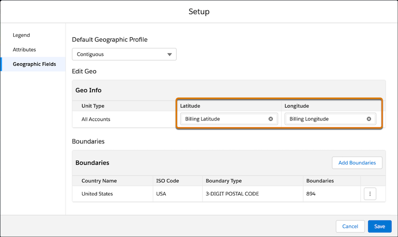
          If your data source doesn’t specify latitude or longitude fields, the created alignment queries the underlying source object and auto-populates latitude and longitude values.

          For example, maybe you created a recipe for the Account object in CRM Analytics, but you didn’t include latitude or longitude fields. Territory Planning detects that the recipe is based on the Account object and queries that object for the values.

          The Setup window for a territory plan, showing the Geographic Fields tab and the auto-populated latitude and longitude values

          Although the field values auto-populate, the field itself isn’t visible in the territory legend unless you add the field to your data source.

          Note
          Note This functionality isn’t available if your data source is a report.

          Matching Strings for Field Names on Boundary Sets

          When you create an alignment from live data, geographic fields other than latitude and longitude are mapped to boundary sets. Territory Planning attempts to match field names in this priority order.

          • First, checks for an exact match, such as BillingLatitude, BillingLongitude, BillingCountry, BillingPostalCode.
          • Otherwise, checks for a partial match, such as any field that contains latitude or longitude.
          • Otherwise, leaves the field blank and you have to manually populate it.
           
          Loading
          Salesforce Help | Article